Walks and Hikes from Costa Teguise
Costa Teguise is flat, but step outside the town in any direction and you are on volcanic terrain with trails, craters, and coastal paths. These are the walks we recommend from the villa, from a 20 minute stroll along the promenade to a proper day hike up a volcanic crater.
Montaña de Tinaguache
5 km circular · 225 m elevation gain · 1 to 1.5 hours
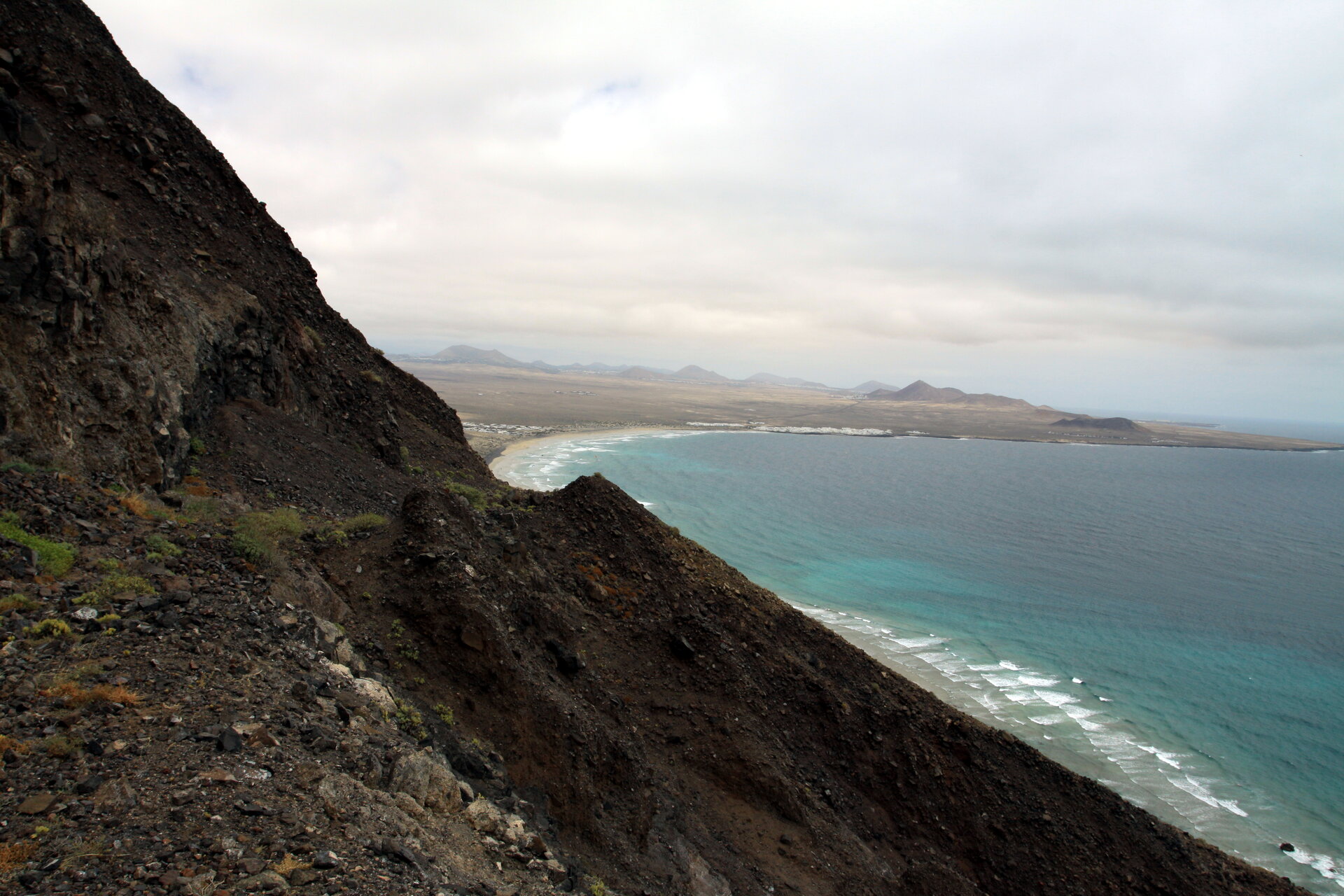
The closest volcano walk to Costa Teguise and the one we always tell guests about. Montaña de Tinaguache is the volcanic cone you can see to the north of town. The circular route around it takes about an hour, climbing up to the crater rim with views over the whole of Costa Teguise, the coast, and the volcanic interior of the island.
The easiest approach is along the ridge. From the parking area on the north side of town, cross the road and head straight up. Do not go left from the car park, that path loops around and adds 30 minutes for no reason. The ridge climb takes about 20 minutes and is steady rather than steep. Once on the rim, you can walk around the crater and descend on the other side to complete the loop.
A few things to know before you go. The north face is loose and slippery, so avoid it as a descent route. The top is extremely windy almost every day, especially in the afternoon. There is zero shade on the entire route, so bring water and go early. Proper hiking shoes are essential because the volcanic rock is sharp and uneven. If you are walking with children, keep them close on the descent where the path narrows.
You can walk to the trailhead from Casa Los Alisios without a car. Mornings before 10:00 are the best time: cooler, calmer, and quieter.
Get directions from Casa Los Alisios · Photos and directions on Google Maps
Paseo Marítimo de Costa Teguise
3 km one way · Flat · Paved · Stroller and wheelchair friendly
The coastal promenade runs from Playa Bastian at the south end of Costa Teguise up past Los Charcos, Las Cucharas, Jablillo, and on to El Ancla. It is flat, smooth, and paved the whole way. You can walk it in trainers or flip flops, and it works just as well with a pushchair or wheelchair.
Most people do it as a morning or evening walk with beach stops and ice cream in the middle. From Casa Los Alisios, the nearest point of the promenade is about 10 minutes on foot. A full out-and-back takes about an hour at a relaxed pace.
If you keep going south past Bastian, the promenade continues all the way to Arrecife, Playa Honda, Matagorda, and eventually Puerto del Carmen. The full Lanzarote coastal path is 26 km. Not a day walk for most people, but good to know it exists if you are a runner or cyclist looking for a flat, car-free route.
For a full guide to every beach along the promenade, see our best beaches in Costa Teguise post.
Get directions from Casa Los Alisios · Photos and directions on Google Maps
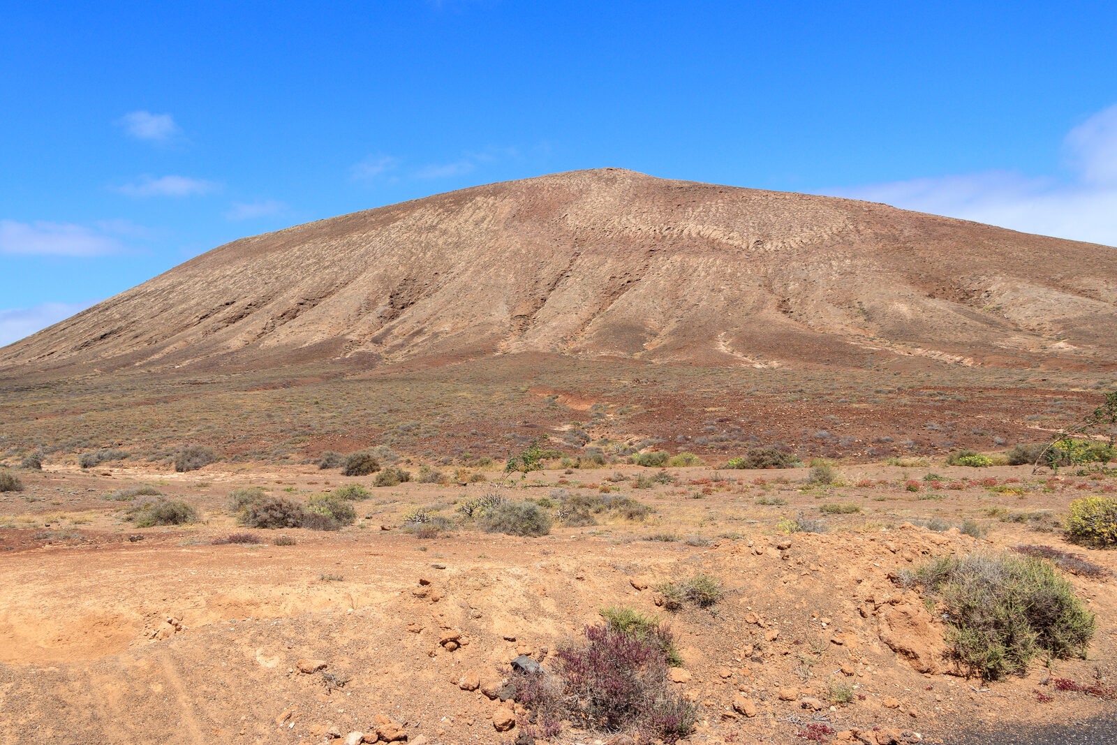
Montaña de Tinaguache and Tejia Loop
9.5 km circular · 260 m elevation gain · 2.5 to 3 hours
If the basic Tinaguache circuit is too short, the extended loop adds Montaña de Tejia as a second volcanic cone. The route covers 9.5 km with about 260 metres of total climbing and takes 2.5 to 3 hours at a moderate pace. It is the same volcanic terrain but a longer, more varied day out with different views from each summit.
The climb is steady and steep in places, depending on which direction you take. Hiking poles help on the loose volcanic gravel, and you will want sturdy shoes rather than trainers. Like the shorter Tinaguache route, there is almost no shade, so bring at least a litre of water per person. If you are here in spring, the wildflowers between the two mountains are surprisingly good for an island that looks so barren from a distance.
Get directions to the trailhead · Trail map on AllTrails
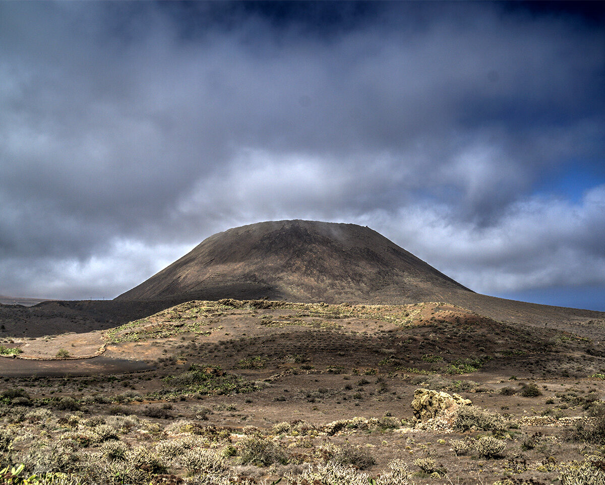
Montaña Corona
3.4 km return · 139 m elevation gain · About 35 minutes to the crater rim
The best short hike within day trip distance of Costa Teguise. Montaña Corona is a large extinct volcanic cone in the north of the island, about 30 minutes by car from the villa. The trail starts from the village of Ye and follows a dirt road before climbing up to the crater rim.
The crater itself is deep and impressive. You can walk around part of the rim but cannot go inside because of the risk of falling rock. Views from the top cover the whole north of Lanzarote and the ocean towards La Graciosa. Like every high point on the island, it is ferociously windy at the top, so bring a windproof layer even on a warm day. The trail surface is loose rock and gravel, so closed shoes with some grip are a minimum.
This pairs well with a visit to Jameos del Agua or Cueva de los Verdes, both of which are nearby in the same part of the island.
Get directions from Casa Los Alisios · Trail map on AllTrails
Pico del Ria
Short detour · Open terrain
A smaller peak east of Tinaguache, closer to the coast. Less well-known and less visited, which is part of the appeal. The views towards the ocean are worth the short detour if you are already walking in the volcanic terrain north of town. There is no formal trail, just a scramble up from the surrounding paths, so it feels more like exploring than following a route.
Get directions from Casa Los Alisios · Photos and directions on Google Maps
Red de Paseos: The Town Walking Routes
Costa Teguise has three official colour-coded walking loops called the Red de Paseos. They are waymarked through town and along the coast:
- Green Route (4.6 km) — The shortest loop, connecting Playa Jablillo, Playa Bastian, and Las Cucharas along the promenade
- Blue Route (6.5 km) — Extends the green route south towards the old King’s house area
- Red Route (10 km) — The longest loop, stretching further north into the volcanic terrain above town
The green and blue routes are paved or well-maintained gravel, so trainers are fine. The red route heads out of town into rougher terrain where you will want proper shoes. Once you leave the built-up area, you start seeing white cattle egrets in the fields and local kestrels hunting lizards on the volcanic rock. It is a different Lanzarote from the resort strip.
What to bring on any walk here
Lanzarote is volcanic, exposed, and windy. Even the “easy” walks have no shade once you leave the promenade. Water, sun protection, proper footwear (volcanic rock is sharp and will shred thin soles), and a windproof layer for any summit. Mornings before 10:00 are the calmest and coolest time to walk.
Frequently Asked Questions
- Can you walk straight from Costa Teguise into hiking trails?
- Yes. Montaña de Tinaguache is walkable from most of Costa Teguise without a car. The coastal promenade starts at the south end of town. Both are accessible any time of day.
- How long is the Costa Teguise coastal promenade?
- About 3 km from end to end (Playa Bastian to El Ancla). A round trip along the full promenade takes roughly an hour at a relaxed pace. It is flat and paved.
- Is Montaña de Tinaguache suitable for beginners?
- The ridge approach takes about 20 minutes and is manageable for most fitness levels. The north side is slippery and it is very windy at the top. Proper footwear is essential, and the trail has no shade.
- What is the best hike near Costa Teguise for views?
- Montaña de Tinaguache gives panoramic views of Costa Teguise, the coast, and the volcanic interior. For an even bigger panorama, Montaña Corona (30 minutes drive, 35 minutes hike) offers views across the whole north of Lanzarote.
- Are there marked walking routes in Costa Teguise?
- Yes. The Red de Paseos system has three colour-coded loops: Green (4.6 km), Blue (6.5 km), and Red (10 km). They are waymarked and start from the town centre.
Planning your trip? Book Casa Los Alisios